Ghost Town of Palmer, Oregon
Ghost Town of Palmer, Oregon
There isn’t much history behind Palmer Oregon. It’s about three miles up the hill from Bridal Veil. It was built at about the same time as Bridal Veil by the Bridal Veil Lumber Company. Before the saw mill was built, logs were sent down a log flume to Bridal Veil to be cut. After the saw mill was built, planks were sent down.
A post office was established February 21st, 1898 and closed December 15th, 1919. Idona A. Pulley was the first post master. But, Oregon Geographic Names says that the office was named for the President of the Bridal Veil Lumber Company, Loren C. Palmer. Oregon Post Offices 1847-1982 says that it was named for the family of the second Postmaster, Bertha Palmer. I’d be interested to know if Loren C. Palmer and Bertha Palmer were related.
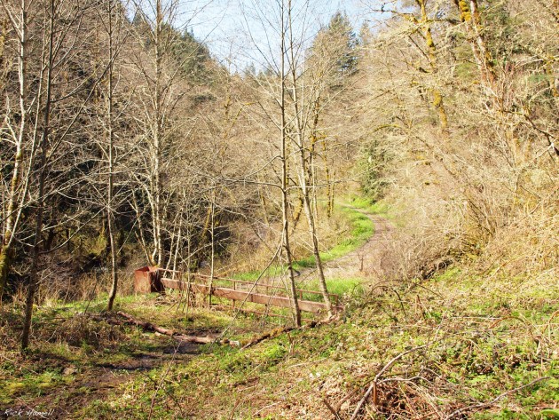
This flat area across the river on the road up is most likely the old log flume. It’s almost perfectly straight for several hundred feet and has a slight down grade.
If you go directly to the left of this gate, down into the river, there is a straight ledge that spans the river. Unfortunately it’s so covered in vines that I couldn’t get a closer look or a picture. This is most likely part of the saw mill, and probably created the waterfall needed to power the saw.
Under this brush I found a few pieces, old lumber and metal. Not sure if this is newer or dates all the way back to Palmer’s glory days.
This looks to be a skid road to me. Logs were shoved down this “road” on to the receiver of the saw mill. They were then positioned in front of the saw, and cut.


Hey Rick, I tried to get to this location today. You should post the GPS coordinates like you did on the MDO forums. It looks like I was close but not close enough. BTW, where are you getting this information? I’m really curious why you think the location is so far from your sources….
Best,
get the GPS coordinates from http://Lat-long.com It’s the best site I’ve found for that but the reality is that surveyors before the 1940s were not always accurate. All of the descriptions I’ve read of Palmer say that it lays along Bridal Veil Creek. So a few hours of tromping around found me the site I took photos of. I found the remains of the log flume and walked up the creek as far as could past that gate on the right I mentioned. I did not get up on the bluff though as I didn’t know the town expanded that far up. You can see a switch back road though so that makes sense now.
We tried to find it via Palmer Mill Rd. today. On the east side of the Creek the road goes up into the hills, following the creek. Judging by the direction and the cut through the bluffs. We left the road and took a secondary (logging?) road with a worn out sign on a tree that had no legible letters. We reached the top of the bluff and found several old tires, an empty rusted out gas drum with what may have been a paint can tucked inside it. When we reached flat, there were a few different trails that we could have taken, none marked. We found a recently clear cut area with a stand of Alders and what may have been a section of fire break from the Eagle Creek Fire a couple years ago. We found a rusted cable, of the kind you’d lift logs with in a block and tackle. No sign of lumber or other metal, but we were hiking over some left over snow and flattened black berries in the clearing. We did not see the gate in your picture, but did go through a different one when we left the main road. We also saw across the creek what looked like a nice flat, slightly sloped section that went around the corner of a bluff, but on the east/south end it looked like a slide had covered it up, just before a small creek came down to join the bigger one.
Thank you for the update! I’d love to try to get up there again someday!